ENTERTAINMENT
These are the provinces that will be affected by the tropical low

Residents living in the the lowveld regions of Mpumalanga and Limpopo, and northern KwaZulu-Natal should brace for a spell of windy, rainy weather between Tuesday and Thursday this week.
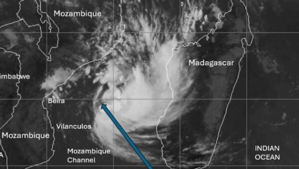
The South Africa Weather Service (SAWS) reported a weak tropical low-pressure system positioned in the Mozambique Channel, between Mozambique and Madagascar.
SAWS said that during the past week, the system has drifted slowly around the eastern and southern parts of the Mozambique Channel region, causing heavy thundery downpours over the eastern coastline of Madagascar.
This is the current predicted track for this system. The curved, parabolic track suggests that the system is likely to be overland, over southern Mozambique during Tuesday, then exiting southern Mozambique near Xai-Xai on Wednesday.

SAWS reports thus far surface winds in association with the system have not been particularly strong or damaging.
However, in the days ahead, the system is expected to begin deepening and intensifying.
According to predictions, the system will continue moving towards the central Mozambique coastline, whilst undergoing a steady but gradual intensification.
The South African Weather Service will continue to monitor any further developments relating to this weather system and will issue subsequent updates as required.
What is a tropical low?
A tropical low is also known as a low pressure system.
Atmospheric pressure, or air pressure, is the force exerted onto a surface by the weight of the air above it.
We call the areas with lower pressure low-pressure systems. In low-pressure systems, air rises, leading to more unstable air and poor weather. Low-pressure systems often result in unstable air, clouds, and precipitation – ranging from light drizzle to heavy storms.
Full Story Source: These are the provinces that will be affected by the tropical low