


Zuko Komisa


- Slow-moving storm systems are expected to bring heavy downpours, large amounts of small hail, and damaging winds.
- Authorities warn of localised flooding on low-lying roads and bridges, alongside potential disruptions to power, water, and communication services.
- While most regions face threats, specific exemptions in KwaZulu-Natal include coastal hubs like eThekwini and KwaDukuza.
The South African Weather Service (SAWS) has issued an urgent warning for severe thunderstorms affecting several provinces this Wednesday, including the Northern Cape, Gauteng, Limpopo, Mpumalanga, and KwaZulu-Natal.
A surface trough is driving intense weather in the Northern Cape’s Karoo Hoogland District, where infrastructure and settlements are at risk.
In Gauteng, Limpopo, and Mpumalanga, the combination of “excessive lightning” and strong winds may cause damage to property, livestock, and informal settlements.

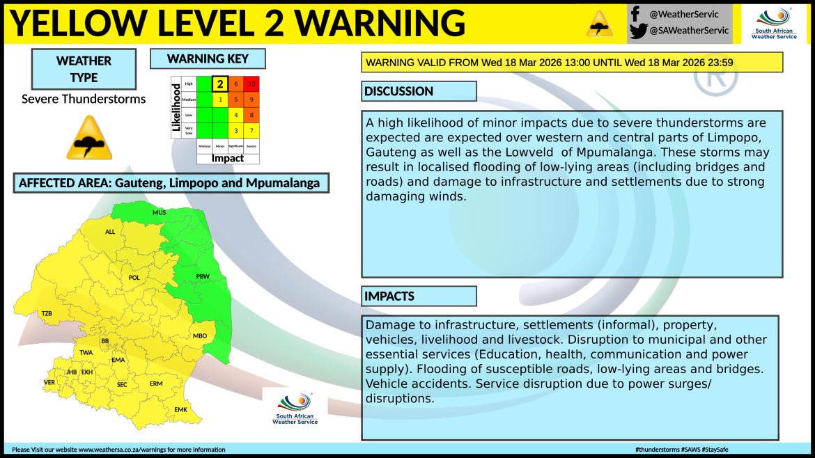
Drivers are urged to exercise extreme caution as slippery roads and poor visibility increase the risk of accidents.
The current volatility is caused by a slow-moving “upper trough” an elongated area of low atmospheric pressure.
Because these systems move slowly, they allow storms to hover over a single area for longer periods, significantly increasing the volume of rainfall and the likelihood of flash flooding compared to fast-moving summer storms.
READ NEXT: April electricity hike sparks calls for affordable pricing options
The post SA weather warning: Five provinces braces for damaging severe thunderstorm appeared first on KAYA 959.