


By Mapaballo Borotho
- The South African Weather Service has issued a Level 4 warning for severe thunderstorms, raising concerns about flooding and infrastructure damage.
- Several provinces, including the Northern Cape, Free State, and North West, are expected to be hardest hit.
- Motorists are also warned of poor visibility due to fog and urged to exercise extreme caution on the roads.
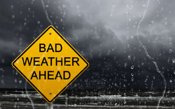
South Africans have been urged to exercise extreme vigilance following a Yellow Level 4 impact-based warning for severe thunderstorms issued by the South African Weather Service (SAWS).
If you’ll be on the road this long weekend, motorists are advised to practise patience and remain cautious at all times to avoid unnecessary accidents.
The warning highlights the likelihood of slow-moving thunderstorms accompanied by heavy downpours, which may result in localised flooding and damage to vulnerable infrastructure across South Africa.
Provinces most likely to be affected include the Northern Cape, Free State, and North West, while damaging waves may develop along the coastline in parts of the Eastern Cape.
Yellow level 4 warning for severe thunderstorm
Area: Northern Cape, North West and Free State
Validity: 30 April 2026 – 01 May 2026#saws #Warning #weatheroutlook #flood pic.twitter.com/HE14HLS72W— SA Weather Service (@SAWeatherServic) April 30, 2026
Meanwhile, fog has set in over the eastern parts of the country on Thursday morning, with visibility reported as poor to very poor.
Motorists are urged to drive slowly, keep their headlights on, and remain alert to ensure safety on the roads.
Observed fog in Gauteng this morning.
Image supplied by @hlonithobela pic.twitter.com/hnycTiBCsB— SA Weather Service (@SAWeatherServic) April 30, 2026
READ NEXT: A month without electricity: this is what Alex residents are subjected to
The post Be cautious as floods and thunderstorms may hit this long weekend appeared first on KAYA 959.